Parks & Legends

Midwest & Plains
Voyageurs National Park
Minnesota
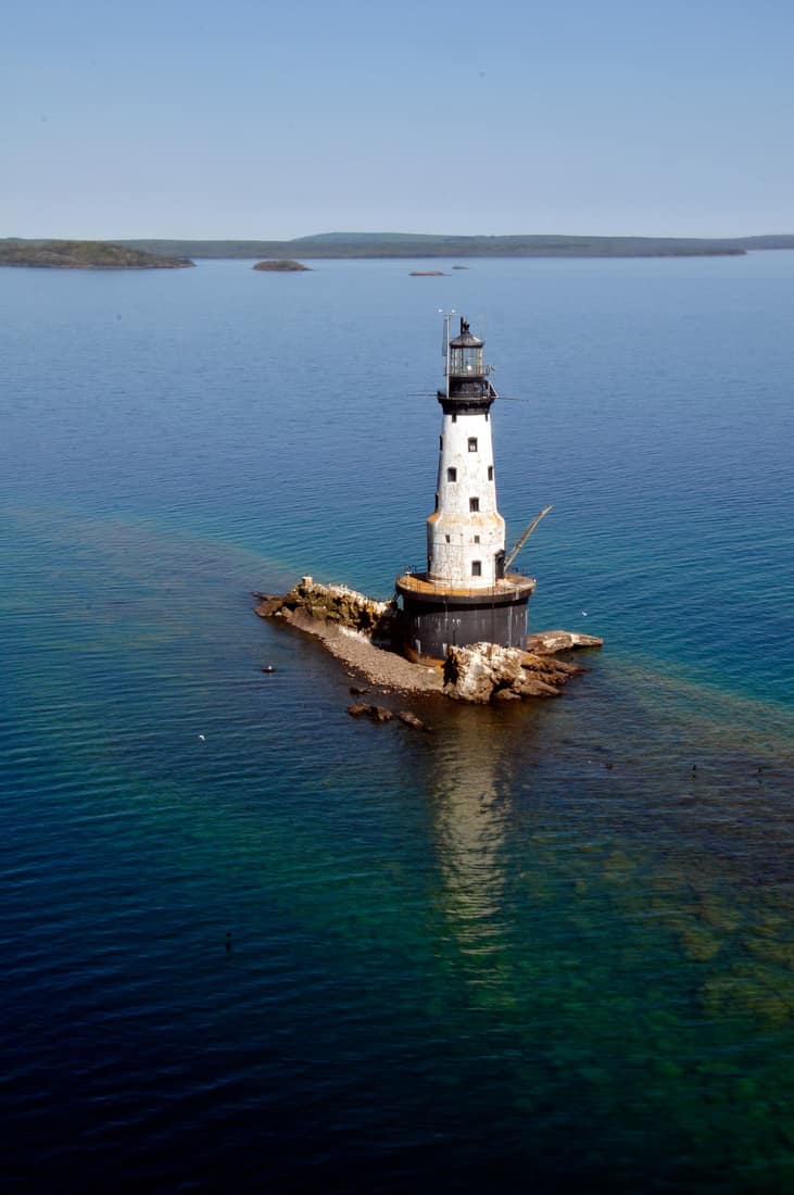
Photo: NPS Photo / Daniel Dendler. Public domain (NPS).
This page collects facts and tools for Voyageurs from official National Park Service data, with the source and check date shown below. Confirm current conditions on nps.gov before you go.
- StateMinnesota
- Protected since1971
- 2025 visits206,326 (#53 of 64)
- EntranceNo standard entrance fee
- QuietestJan, Apr, Dec
Authorized 1971; established 1975. Source: NPS park anniversaries and the 2025 visitation report (checked 2026-11-16).
Voyageurs in photos
1 / 11
Things to see in Voyageurs
Hike Blind Ash Bay Trail
“This narrow, winding, rocky trail exposes users to the wonders of the boreal forest.” NPS
Official details on nps.gov for Hike Blind Ash Bay Trail ↗Hike the Locator Lake Trail
“Please note: The Cranberry Creek Portage Trail into Locator Lake from Rainy Lake has been permanently closed.” NPS
Official details on nps.gov for Hike the Locator Lake Trail ↗Hike Black Bay Beaver Pond Trail
“Take a boat one mile from the visitor center and hike this trail through northern pine country to a scenic, active beaver pond.” NPS
Official details on nps.gov for Hike Black Bay Beaver Pond Trail ↗Hike Kab-Ash Trail
“Please note: The Salmi Road entrance to the Kab-Ash Trail in the Kabetogama community is closed (click to see map).” NPS
Official details on nps.gov for Hike Kab-Ash Trail ↗Hike the Oberholtzer Trail
“Wander through deciduous and conifer forest as the trail twists around the edge of a cattail filled wetland and past rocks deposited by ancient glaciers.” NPS
Official details on nps.gov for Hike the Oberholtzer Trail ↗Rainy Lake Ethnobotanical Garden
“This one-acre garden of native plants restores a site that had been overtaken by invasive plants near the Rainy Lake Visitor Center.” NPS
Official details on nps.gov for Rainy Lake Ethnobotanical Garden ↗
Short quotes come from the official National Park Service pages for each place. Photos: NPS, public domain.
When to go: quiet and busy months
Quietest months: Jan, Apr, Dec. Busiest months: Jun, Jul, Aug. The park received 206,326 recreation visits in 2025 (quieter by our thresholds).
A low month can also mean closed roads or harsh weather, not just fewer people. Check conditions with the park before you go. Source: NPS Visitor Use Statistics, checked 2026-11-17. Our calculation, not an NPS figure.
Where it is
Getting there: nearest airports
| Airport | Straight line | By road (approx.) |
|---|---|---|
| Falls International Airport (INL) International Falls, MN | 26 mi | ≈ 37 road mi |
| Range Regional Airport (HIB) Hibbing, MN | 76 mi | ≈ 91 road mi |
| Duluth International Airport (DLH) Duluth, MN | 117 mi | ≈ 141 road mi |
| Minneapolis–Saint Paul International Airport / Wold–Chamberlain Field (MSP) Minneapolis, MN | 250 mi | ≈ 285 road mi |
Airports: OurAirports (public domain, checked 2026-11-17); airports with listed scheduled service, nearest by straight line from the park center. Confirm flights with the airline, since some small airports have seasonal or very limited service. Approximate road distance from the park's center point (not its entrance), so the real drive to the gate is usually shorter; check your route before you go. Routing by OSRM on © OpenStreetMap contributors, checked 2026-11-17.
Directions, from the NPS: Voyageurs National Park is located in Northern Minnesota near the Canadian border. Access to Voyageurs is available from many points along Rainy Lake, Kabetogama Lake, Ash River, Crane Lake, and Orr/Pelican Lake. The park's visitor centers and many trails can be reached by car, but much of Voyageurs is best explored by boat. All campsites in the park, except primitive, require a boat to reach. (NPS Data API, checked 2026-11-17)
Fees and reservations
- Entrance: No standard entrance fee. NPS fees page, checked 2026-11-16.
- Reservations: not in our reservation table yet. Check the park's official page before you go.
Add Voyageurs to my road trip cost Compare fees across parks
Hours, from the NPS: Voyageurs is open 24-hours a day year-round, although activities and services are limited after visitor center hours. Please note that early spring and late fall may present hazards on the lake with thin ice; use caution. (NPS Data API, checked 2026-11-17)
Weather, from the NPS: There are four distinct seasons in Voyageur country. During June, July, and August periods of fine, mild weather prevail. The frost-free season averages 120 days from June to mid-September. The average ice-out date is May 3. The first measurable snowfall occurs in late October and the last in late April or early May. (NPS Data API, checked 2026-11-17)
Nearby national parks
- Isle Royale187 mi straight lineroad distance not estimated
- Theodore Roosevelt499 mi straight lineroad distance not estimated
- Indiana Dunes549 mi straight lineroad distance not estimated
- Badlands568 mi straight lineroad distance not estimated
- Wind Cave610 mi straight lineroad distance not estimated
Straight line between the park center points listed by the NPS. Drive estimates: see the airport note above.
Our guides and tools
- Least Crowded National Parks (NPS Visitation Data, Ranked)
- National Parks to Visit in Winter: Open vs. Closed
- Road trip cost plannerEntrance fees, passes and reservations for your dates
- 64 parks checklistMark Voyageurs when you visit and get a badge: download the Voyageurs badge
- Map of all 64 parksFilter by region or quiet month
- Find your parkFilter by crowds, fees and reservations
Sources
- Voyageurs on nps.gov (official park page), checked 2026-11-17
- NPS Visitor Use Statistics: monthly recreation visits, checked 2026-11-17
- NPS annual visitation 2025 (DataStore), checked 2026-11-16
- OurAirports open data (airports, public domain), checked 2026-11-17
- OSRM routing on OpenStreetMap data (FOSSGIS server), approximate road distances, checked 2026-11-17
- Park locations: NPS developer API (park center point), checked 2026-11-17
- Entrance fees (NPS), checked 2026-11-16
- NPS Data API (weather, directions, hours), checked 2026-11-17
Not affiliated with the National Park Service. Estimates are marked as estimates; anything we could not verify is left out.