Parks & Legends

East, Southeast & Caribbean
Hot Springs National Park
Arkansas
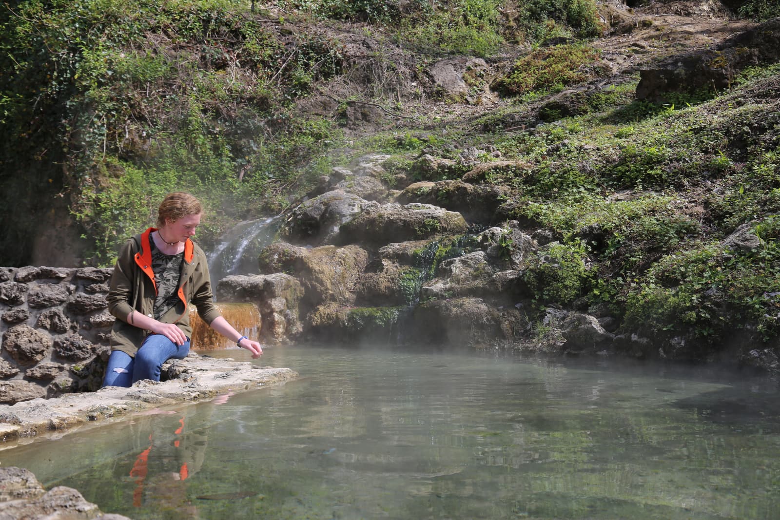
Photo: NPS photo. Public domain (NPS).
- StateArkansas
- Protected since1832
- 2025 visits2,494,611 (#14 of 64)
- EntranceNo standard entrance fee
- QuietestSep, Oct, Nov
Hot Springs Reservation 1832; National Park 1921. Source: NPS park anniversaries and the 2025 visitation report (checked 2026-11-16).
Hot Springs in photos
1 / 11
Things to see in Hot Springs
Goat Rock Trail
“The Goat Rock trail offers stunning views of the Ouachita Mountains and the recharge zone for the thermal springs.” NPS
Official details on nps.gov for Goat Rock Trail ↗Oak Trail
“The northeastern end of Oak Trail is mostly flat.” NPS
Official details on nps.gov for Oak Trail ↗An Overview: Hot Springs and North Mountain Trails
“The Hot Springs and North Mountain trails are popular since they are easy to reach and provide scenic views.” NPS
Official details on nps.gov for An Overview: Hot Springs and North Mountain Trails ↗Honeysuckle Trail
“Honeysuckle Trail connects Peak Trail with Hot Springs Mountain Trail.” NPS
Official details on nps.gov for Honeysuckle Trail ↗Short Cut Trail
“Short Cut Trail connects Oertel Trail with Hot Springs Mountain Trail near the picnic area atop Hot Springs Mountain.” NPS
Official details on nps.gov for Short Cut Trail ↗Arsenic Spring
“Arsenic Spring is the northernmost of the springs located along Hot Springs Creek.” NPS
Official details on nps.gov for Arsenic Spring ↗Balanced Rock
“Balanced Rock is located on Sugarloaf Mountain along Sunset Trail between Blacksnake and Cedarglades Road.” NPS
Official details on nps.gov for Balanced Rock ↗Big Iron Spring
“Big Iron Spring is the largest and one of the hottest springs in Hot Springs.” NPS
Official details on nps.gov for Big Iron Spring ↗
Short quotes come from the official National Park Service pages for each place. Photos: NPS, public domain.
When to go: quiet and busy months
Quietest months: Sep, Oct, Nov. Busiest months: Mar, Jun, Jul. The park received 2,494,611 recreation visits in 2025 (very busy by our thresholds).
A low month can also mean closed roads or harsh weather, not just fewer people. Check conditions with the park before you go. Source: NPS Visitor Use Statistics, checked 2026-11-17. Our calculation, not an NPS figure.
Where it is
Getting there: nearest airports
| Airport | Straight line | By road (approx.) |
|---|---|---|
| Memorial Field Airport (HOT) Hot Springs, AR | 4 mi | ≈ 5 road mi |
| Bill & Hillary Clinton National Airport/Adams Field (LIT) Little Rock, AR | 50 mi | ≈ 57 road mi |
| Texarkana Regional Airport (Webb Field) (TXK) Texarkana, AR | 91 mi | ≈ 112 road mi |
| Frederick W. Smith International Airport (MEM) Memphis, TN | 179 mi | ≈ 199 road mi |
Airports: OurAirports (public domain, checked 2026-11-17); airports with listed scheduled service, nearest by straight line from the park center. Confirm flights with the airline, since some small airports have seasonal or very limited service. Approximate road distance from the park's center point (not its entrance), so the real drive to the gate is usually shorter; check your route before you go. Routing by OSRM on © OpenStreetMap contributors, checked 2026-11-17.
Directions, from the NPS: From Little Rock: Take I-30W towards Texarkana. Exit 111 for US 70W/Hot Springs. Turn Right onto Spring St. Turn Right onto Central Ave. Drive North, the Park will be on the right after Reserve St. From Texarkana: Take 1-30E. Exit 78 for AR-7 and turn left under the highway. Follow AR-7 North for 31 miles. AR-7 becomes Central Ave., the Park will be on the right after Reserve Street. (NPS Data API, checked 2026-11-17)
Fees and reservations
- Entrance: No standard entrance fee. NPS fees page, checked 2026-11-16.
- Reservations: not in our reservation table yet. Check the park's official page before you go.
Add Hot Springs to my road trip cost Compare fees across parks
Hours, from the NPS: Arlington Lawn, Grand Promenade, sidewalks on Bathhouse Row, Reserve Street, and Fountain Street, except for walk through traffic, are open from to 5:00 am to 10:00 pm, daily. Roads to Hot Springs Mountain, North Mountain and West Mountain Summit are open to vehicle traffic from 8:00 am to 10:00 pm. (NPS Data API, checked 2026-11-17)
Weather, from the NPS: Average temperatures in Hot Springs can range from about 90°F (32°C) to less than 27°F (-2.7°C). Summer days can be hot and humid, with heat index values up to 110ºF (43ºC). Winter wind chills can make temperatures feel much colder, as low as 15ºF (-9.4ºC). Spring and fall typically have the most rainfall. Generally, Hot Springs experiences mild weather throughout the year. (NPS Data API, checked 2026-11-17)
Nearby national parks
- Gateway Arch325 mi straight lineroad distance not estimated
- Mammoth Cave430 mi straight lineroad distance not estimated
- Great Smoky Mountains545 mi straight lineroad distance not estimated
- Indiana Dunes589 mi straight lineroad distance not estimated
- Carlsbad Caverns683 mi straight lineroad distance not estimated
Straight line between the park center points listed by the NPS. Drive estimates: see the airport note above.
Our guides and tools
- Least Crowded National Parks (NPS Visitation Data, Ranked)
- National Parks to Visit in Winter: Open vs. Closed
- Road trip cost plannerEntrance fees, passes and reservations for your dates
- 64 parks checklistMark Hot Springs when you visit and get a badge: download the Hot Springs badge
- Map of all 64 parksFilter by region or quiet month
- Find your parkFilter by crowds, fees and reservations
Our take on Hot Springs
What makes it different
Located in Hot Springs, Arkansas (54 miles, about 1 hour from Little Rock), Hot Springs National Park protects over 4,000-year-old thermal water that comes out of the ground at 143°F. Its downtown core, Bathhouse Row, preserves eight bathhouses built between 1892 and 1923—the largest collection of early-20th-century bathhouses remaining in the United States—and was designated with the Grand Promenade as a National Historic Landmark District in 1987. Beyond downtown, the park has 26 miles of hiking trails; see our guide to mysterious places in U.S. national parks.
How many days you need
The itineraries below are an editorial suggestion for pairing the historic district with the surrounding ridges:
- 1 day: Tour the Fordyce Bathhouse Visitor Center (on Bathhouse Row), walk the half-mile Grand Promenade, touch the thermal water at Display Spring and Hot Water Cascade, soak at Buckstaff or Quapaw Bathhouse, and visit the 216-foot Hot Springs Mountain Tower.
- 2 days: Add West Mountain Scenic Drive and its three overlooks, climb the 0.6-mile Peak Trail or walk the 1.7-mile Hot Springs Mountain Trail, or hike the Sunset Trail to Balanced Rock Overlook on Sugarloaf Mountain.
Top things to do
- Fordyce Bathhouse Visitor Center — Take a free self-guided tour of each of the 3 floors and the basement of the bathhouse that operated from 1915 to 1962.
- Soak on Bathhouse Row — Contact Buckstaff Bathhouse (opened in 1912, for people 10 and older) or Quapaw Bathhouse (for people 14 and older) about baths and spa services.
- Grand Promenade & Open-Air Springs — Walk the half-mile Grand Promenade and touch the thermal water at Display Spring and Hot Water Cascade.
- Fill Jugs at Spring Fountains — Fill bottles free of charge at the park’s thermal and cold spring jug fountains (the cold springs are Happy Hollow and Whittington Spring). The same page notes that Legionella bacteria have been identified in some water samples, and says that “the concern does not lie with bathing or with drinking water.”
- Hot Springs Mountain Tower — Visit the 216-foot tower, whose open-air upper deck sits 1,256 feet above sea level, and overlook 140 square miles.
- Mountain Scenic Drives — Drive Hot Springs Mountain Drive and West Mountain Drive to six scenic overlooks, the 1911 Pagoda, and a view toward Lake Hamilton.
Without a long hike
The Fordyce Bathhouse Visitor Center has an elevator that allows access to all floors, and the half-mile Grand Promenade has ramp access at Fountain Street and behind the Fordyce Bathhouse (the Reserve Street entrance has stairs). Drivers can reach six scenic overlooks along Hot Springs Mountain Drive and West Mountain Scenic Drive and visit the Hot Springs Mountain Tower.
First-timer mistakes
- Expecting outdoor soaking pools: There are no outdoor soaking opportunities in the park; Bathhouse Row has 2 facilities, Buckstaff and Quapaw, where visitors can submerge.
- Showing up at Gulpha Gorge Campground without a reservation: All 40 sites at Gulpha Gorge Campground require prior reservation on Recreation.gov and cost $34 per night.
- Overlooking bathhouse age rules: Buckstaff offers baths for people 10 and older, and Quapaw is for people 14 and older.
FAQ
Do I need a reservation? No entrance pass is required to access the park (Fees & Passes). The Fordyce Bathhouse tour is free and self-guided. For services, rates, and reservations at the bathhouses, visit their websites or call them directly. All 40 sites at Gulpha Gorge Campground require prior reservation on Recreation.gov ($34 per night); see our reservations guide. Last checked: 2026-11-18.
When is the best time to visit? See the park’s Operating Hours page for current hours; bathhouses are run by private and non-profit businesses who set their own hours. The scenic overlooks page recommends the six overlooks for “the sunrise, the sunset, fall colors”.
Are dogs allowed? Yes. Dogs are welcome on all 26 miles of trails on a leash no longer than 6 feet, though pets are not permitted inside federal buildings and must wait outside; service animals are allowed in all federal buildings.
Is there cell coverage? Bathhouse Row sits in downtown Hot Springs. The NPS does not publish cell-coverage information for the mountain trails.
What is the entrance fee? No entrance pass is required. The bathhouses are operated by private and non-profit businesses and the Hot Springs Mountain Tower is operated as a concession, so check each operator for its own prices; see our entrance fees guide and pass calculator.
Reviewed by Dani on 2026-11-18.
Sources
- Hot Springs on nps.gov (official park page), checked 2026-11-17
- NPS Visitor Use Statistics: monthly recreation visits, checked 2026-11-17
- NPS annual visitation 2025 (DataStore), checked 2026-11-16
- OurAirports open data (airports, public domain), checked 2026-11-17
- OSRM routing on OpenStreetMap data (FOSSGIS server), approximate road distances, checked 2026-11-17
- Park locations: NPS developer API (park center point), checked 2026-11-17
- Entrance fees (NPS), checked 2026-11-16
- NPS Data API (weather, directions, hours), checked 2026-11-17
Not affiliated with the National Park Service. Estimates are marked as estimates; anything we could not verify is left out.